Jane
Bad Laasphe, North Rhine-Westphalia, Germany
Cycling route: 4012054
Provided by: M.k
01:15 h
Height Profile
Start here your cycling route
You probably can't wait to start your tour, but you have to go to the starting point of the route first. Click the button below to plan your route to the starting point.
Gennernbach
57334 Bad Laasphe
TKS – Tourismus, Kur und Stadtentwicklung Bad Laasphe GmbH
Wilhelmsplatz57334 Bad Laasphe
+49 2752 898
Send an email
Visit the website
Bad Laasphe
Bahnhofstraße57334 Bad Laasphe
Naturschutzgebiet "Buchenwälder und Wiesentäler bei Bad Laasphe"
Naturschutzgebiet "Buchenwälder und Wiesentäler bei Bad Laasphe"57334 Bad Laasphe
Am Rathaus in Bad Laasphe, Duitsland
Dammstraße57334 Bad Laasphe
You do not want to miss this
Below you will find various suggestions for breaks that you can visit during your route. These are divided into different categories, making it easy for you to choose.


Directions
| # | Description | Distance | |
|---|---|---|---|
| AM Fang (Höhenweg, 57334, Bad Laasphe, North Rhine-Westphalia, Germany) | 0.00 km | ||
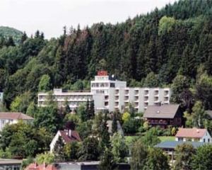
| Hotel Lang (35236, Breidenbach, Hesse, Germany) | 8.52 km | ||
| Wirtshaus Zur Linde Wallauer Gemütlichkeit Wirtshaus (Fritz-Henkel-Straße, 35216, Biedenkopf, Hesse, Germany) | 15.19 km | ||
23 | 23 (57334, Bad Laasphe, North Rhine-Westphalia, Germany) | 19.54 km | |
| AM Fang (Höhenweg, 57334, Bad Laasphe, North Rhine-Westphalia, Germany) | 21.45 km |
Place name directory
Reviews
Rated stars out of 5
Read the experiences of others below. This way you find out what score the route has received and you can decide whether this route is for you. Have fun!
Embed this page </>
See Routiq in...