Around Tilburg 12: SSW (Riel, Regte Heide, Belgium, Goirle)
Tilburg, North Brabant, The Netherlands
Cycling route: 295489
Provided by: Boudewijn Waijers, Utrecht (NL)
02:19 h
Description
The route starts and ends at Tilburg station. It contains an unpaved but well-ridable section. This can be avoided; the route becomes somewhat longer as a result.
From the station we leave in a westerly direction. Soon we pass a striking war memorial . It is located on the facade of the former patronage building, and dates from 1941. It was placed by the residents to beg Mary for protection during the war.
From here we continue past, among other things, the water tower of Tilburg, built in 1897. It is fifty meters high, and contains a reservoir of 1000 cubic meters. The water tower has not been in use since 2008. On your left, you see the former monastery of the Sacred Heart . This is where the annual procession used to depart, in which a relic was carried through the center of Tilburg. In 2015, it was converted into an apartment complex.
A little further, on your right, is the Kromhoutpark , a former barracks. Some of the old buildings of the barracks are still there. A little further, on the corner of Diepenstraat and Jan Steenstraat, is the memorial for Coba Pulskens , a Tilburg resistance fighter from the Second World War. Elsewhere in the city, another avenue is named after her.
We continue the route towards Goirle. On your left you will see the Willem II stadium . Immediately after passing the A58 motorway we turn right. We pass an old sand quarry, now a lake. After crossing the road to Turnhout (Belgium) we pass café-restaurant De Commanderie , where there is also a playground.
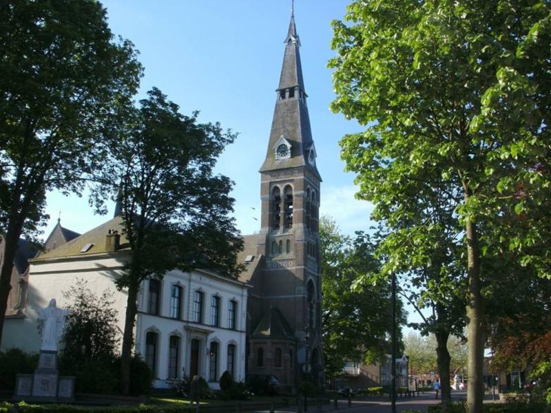
We drive through Riel. On the corner of Dorpsstraat and Beatrixstraat, in a front garden, there is a war memorial . In Riel, you will also find the church, a few catering establishments, and a bicycle repair shop on the village square. We leave the village street and continue through the countryside on the Oude Tilburgsebaan. Some time later, we come to a crossroads where there is a crucifix. Here, we turn left, to the hamlet of Riels Hoefke . You pass an information board.
At the crossroads at the Riels Hoefke, on your right in the forest, there is a Marian grotto from 1920. It is only about ten meters from the road, but is not visible from the road. Here we turn left for about 250 meters on a partly unpaved road. Here we cross the Riels Laag , a stream valley of the Oude Leij with many special flora and fauna.
On the other side you will come to the Regte Heide , one of the larger heathlands of Brabant. Here too there is an information board. The Regte Heide is one of the few places where the marsh gentian still occurs in the Netherlands. You will also find burial mounds from the Bronze Age . We return to the Riels Hoefke, where we now turn left at the crossroads. This is where the unpaved part of this route begins.
If you prefer not to ride on unpaved roads, it is wise to return here to the crucifix and continue your way to junction 74. There you follow the Bels Lijntje to junction 70 and further towards Alphen. Between junction 70 and Alphen you will return to this cycle route'Rondom Tilburg 12\\\'.
The unpaved part of the route is reasonably to well passable, unless it has rained heavily. This part takes you along the stream valley of the Oude Leij and through the forests of the Riels Hoefke. When you have left the forest again, you will find the De Hoevens estate on your left a little further on. Here you will find a campsite, a natural burial ground and a bat cave. Here we go right (from here the road is paved again). A little further on we arrive at the Bels Lijntje , from where the route takes us left to Alphen.
The Bels ('Belgian' in the local dialect) Lijntje is the former railway line from Tilburg via Baarle Nassau to Turnhout. Construction of this 31 kilometre long route began in 1865. Passenger transport ceased in 1934, and the last 'real' train ran in 1973. Until 1982, a tourist steam train ran on the route from Tilburg to the border, but in the late 1980s the entire line was removed and replaced by a tourist cycle path.
Near the former station of Alphen there are now a few catering establishments. From here we follow the road towards Poppel (Belgium) for a while, through the municipality of Baarle-Nassau . Note that the house numbers here are provided with a Dutch flag: in the sister municipality of Baarle-Hertog they are provided with a Belgian flag, so that you can see whether a house is on Dutch or Belgian territory. Finally we cross the border. At junction 51 in the hamlet of Groot Bedaf (Belgium) we turn left onto a cycle path towards junction 75.
This cycle path follows the border between the Netherlands and Belgium. At some point you will see a border post on the left, with an information board. We continue to follow the border on the Belgian side until we reach the hamlet of Aarle, where there is a terrace annex ice cream parlour annex VVV information point at a house. Here we leave Belgium again via the Nieuwe Leij .
A little further on we come to junction 77. Here we go a little bit back and forth to the left; on your left there are the monastery and estate Nieuwkerk or De Ooievaartsnest , and the Naturentuin Goirle . Both can be visited; inquire in advance to avoid disappointment.
We continue to Goirle, on a cycle path located right next to the Nieuwkerksedijk. On your left is the Regte Heide again. In Goirle we cycle through the centre, where there are two war memorials , a tourist office and a mill . Here are many places to have a bite to eat or a drink in and around the De Hovel shopping centre. In the Kerkstraat you will still find many typical old workers' houses . We follow the Abcovenseweg, an old road to Tilburg, where we pass a small petting zoo .
Arriving in Tilburg we pass the Koning Willem II-college . This is the oldest secondary school in Tilburg; it dates back to 1865. In 1948 it was the first and only HBS in the Netherlands to be awarded the title Royal. In 1866, when the school was still located in a palace built by King Willem II , Vincent van Gogh was one of the students here.
The route takes us further past the house where Vincent van Gogh lived during his student years (on the Sint-Annaplein). There is a plaque on the first floor. A little further on, in the middle of the centre of Tilburg, you will pass the palace-town hall , where the aforementioned King Willem II College was once located. It now houses, among other things, the wedding hall of the municipality of Tilburg.
In the centre we pass the chapel of Our Lady of Need , the tourist office and the Hiroshima monument , before finally returning to the station.
Height Profile
© Kees Wittenbols

© TracesOfWar.com

© Henk Eilander

© Traart Molenkamp

© onbekend

© John Scholte

© Wandelpaden.com

© TracesOfWar.nl

© Rolf Fotografie, Tilburg

© Tilburgers.nl

© Rijksmonumenten.nl

© Willem-II.nl

© Hans Briaire

© Collectie RHC Tilburg

© POVO-013

© Brabants Dagblad

© Fam. Dommelen

© Ger en Audrey

© Gemeente Tilburg

© Onbekend

© Stichting 4 en 5 mei

© Onbekend

© Schouwburg Tilburg

© Concertzaal Tilburg

© nlwandel.nl

© Onbekend
You do not want to miss this
Below you will find various suggestions for breaks that you can visit during your route. These are divided into different categories, making it easy for you to choose.
Sights

Directions
| # | Description | Distance | |
|---|---|---|---|
| Tilburg (5038CG, Tilburg, North Brabant, The Netherlands) | 0.00 km | ||
| Monument Boomstraat Tilburg (5038GT, Tilburg, North Brabant, The Netherlands) | 1.10 km | ||
| Watertoren (Park watertoren, 5038NP, Tilburg, North Brabant, The Netherlands) | 1.68 km | ||
| Monument Karl-Heinz Rosch (Karl-Heinz Rosch, 5133AH, Goirle, North Brabant, The Netherlands) | 7.43 km | ||
76 | 76 (Terover, 5131RB, Alphen-Chaam, North Brabant, The Netherlands) | 17.77 km | |
78 | 78 (Pineind, 5111PJ, Baarle-Nassau, North Brabant, The Netherlands) | 19.32 km |
Reviews
Read the experiences of others below. This way you find out what score the route has received and you can decide whether this route is for you. Have fun!
Embed this page </>
See Routiq in...