Beukenburgerpad - clog path
De Bilt, Utrecht, The Netherlands
Hiking route: 1481927
Provided by: J. Jansen, Noord-Holland
03:03 h
Description
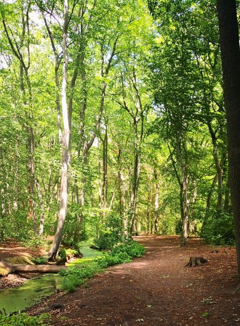
BEEKENBURG PATH
Discover the beautiful countryside of Groenekan and De Bilt. Walking near the city of Utrecht, on the border of the Utrechtse Heuvelrug and the peat meadow area. Enjoy the landscape, historic estates, avenues and Fort Voordorp. Walk along meadows and through avenues. Put on your clogs, backpack and go.
Starting point: Groenekanseweg parking lot at the viaduct under the A27 (near Groenekanseweg 40).
Public transport: Bus stop Groenekan Centrum
Marking: Blue marking in the shape of a clog. The route is marked in two directions, so you can walk the route either left or right.
Discover the beautiful countryside of Groenekan and De Bilt. Walking near the city of Utrecht, on the border of the Utrechtse Heuvelrug and the peat meadow area. Enjoy the landscape, historic estates, avenues and Fort Voordorp. Walk along meadows and through avenues. Put on your clogs, backpack and go.
Circular walk: Beukenburgerpad (13 km)
The approach route from the Voordorp boarding point is 1.2 km. The route is therefore longer.
The approach route from the Voordorp boarding point is 1.2 km. The route is therefore longer.
Starting point: Groenekanseweg parking lot at the viaduct under the A27 (near Groenekanseweg 40).
Public transport: Bus stop Groenekan Centrum
Marking: Blue marking in the shape of a clog. The route is marked in two directions, so you can walk the route either left or right.
Information from: clompingpaths.nl/klompenpad/beukenburgerpad
Height Profile
Directions
| # | Description | Distance | |
|---|---|---|---|
81 | 81 (3737AT, De Bilt, Utrecht, The Netherlands) | 0.00 km | |
17 | 17 (Vijverlaan, 3737RH, De Bilt, Utrecht, The Netherlands) | 0.56 km | |
58 | 58 (Lindenlaan, 3737RD, De Bilt, Utrecht, The Netherlands) | 1.62 km | |
59 | 59 (Lindenlaan, 3737RD, De Bilt, Utrecht, The Netherlands) | 1.69 km | |
58 | 58 (Lindenlaan, 3737RD, De Bilt, Utrecht, The Netherlands) | 1.72 km | |
57 | 57 (3737MD, De Bilt, Utrecht, The Netherlands) | 2.99 km |
Place name directory
Reviews
Read the experiences of others below. This way you find out what score the route has received and you can decide whether this route is for you. Have fun!
Embed this page </>
See Routiq in...